Distance from Nearest Road: 2.7 miles
Cell Phone Coverage: No
Public Land: Yes, Hammersley Wild Area, Susquehannock State Forest
Travel Method: By foot
Travel Time One-Way: 2 hours
Total Hiking Distance: 9.8 miles
Something We Learned: Oil and natural gas extraction is ubiquitous in the Susquehannock State Forest surrounding the Pennsylvania Remote Spot.
Remote Footprints is working to precisely calculate and travel to the remotest locations in each of the 50 United States. We call this unique endeavor–Project Remote. Below is a written account of our 1-day hiking expedition to document the Pennsylvania Remote Spot. This is our 5th state Remote Spot documented as part of Project Remote.
Click on the ‘Play’ button below to view our video from the Remote Spot.
September 12, 2011. First light. September morning air sticks to our skin, and a distinctive chill motivates us to get moving. Temps are in the 50’s.
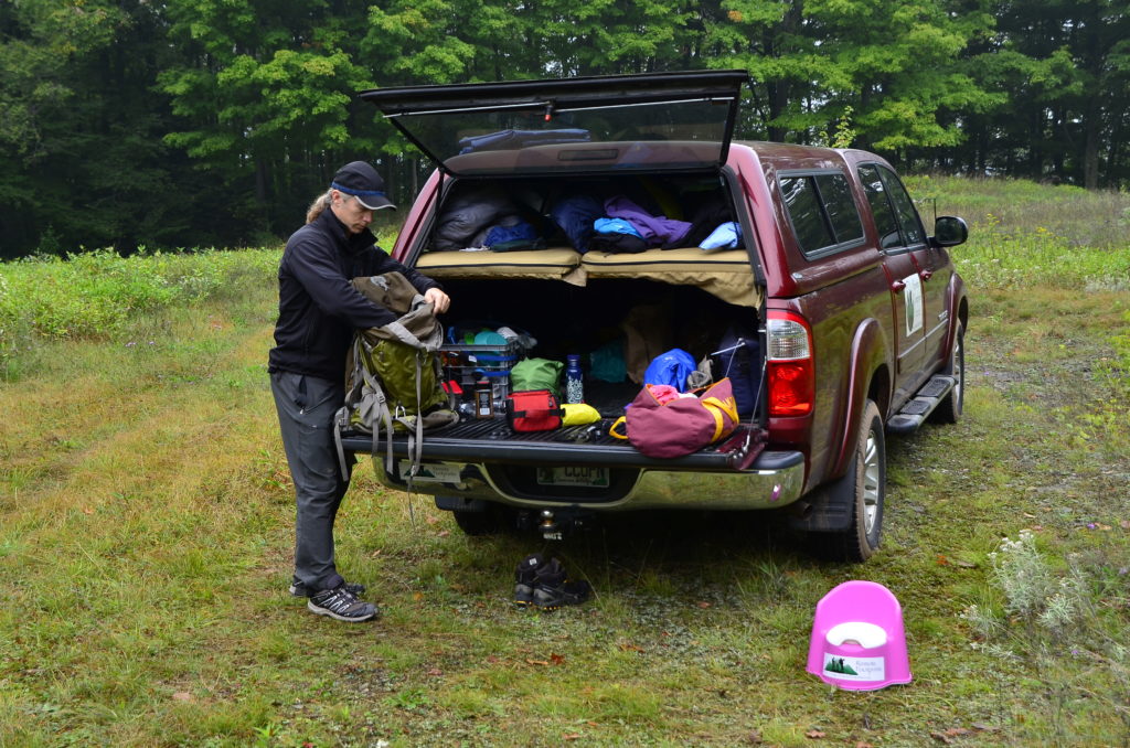
Yesterday, we anxiously drove out of Washington, D.C. on the 10 year anniversary of the 9-11 terror attacks to our great nation. While honoring the memory of those fallen, we were all too happy to leave civilization and Go Remote. By nightfall, we had penetrated deep into the Susquehannock State Forest. We parked and camped along the boundary of the Hammersley Wild Area, the roadless area that contains the Pennsylvania Remote Spot. This position allowed us to get an early start on our documentary trip into the Remote Spot. We slept in our camper shell loft. The loft provides a quick, efficient camp space while traveling between state Remote Spots.

We are excited beyond belief to resume Project Remote for the first time in many months. The realities of logistics and funding have kept us grounded until now…
We pile into the truck and drive a short distance to the beginning of our hike. Along the way, more reality smacks us. Oil and gas extraction is prominent throughout the Susquehannock State Forest. Pumps and stations are unsightly and common along the dirt road matrix in this otherwise beautifully forested public natural area. We now know what the grumbling hum was that we heard all last night while camping. We are now within 3 straight-line miles from the remotest location in all of Pennsylvania and not yet feeling remote. It sobers us to be part of the fossil fuel consumption problem as long as we are driving an automobile. This is one reason why we can’t wait to stop the truck, set out on foot, and experience what is left of Pennsylvania remoteness…
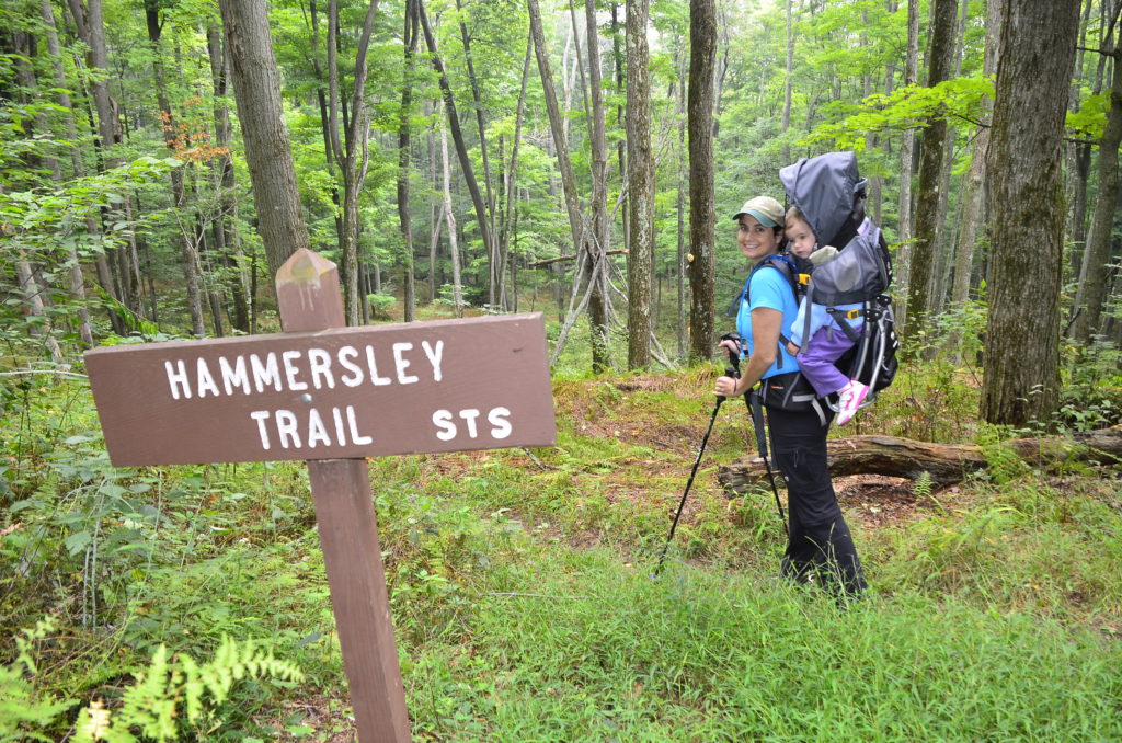
We enter the Hammersley Wild Area (HWA) on the north boundary, and hike southward along the Hammersley Trail, which bisects the HWA. Our calculation revealed that the PA Remote Spot is situated in the center of the HWA, and the Hammersley Trail apparently leads to within 0.1 miles from the Remote Spot. Our task today is to hike along the trail to the closest Remote Spot approach, then set out off-trail to reach the Remote Spot. The entire Hammersley Trail is approximately 10 miles long, and we will need to hike about 4.8 miles to near the center, then back out.

We carry full backpacks to prepare for the possibility of camping overnight. The total distance in and out of the Remote Spot appears to be around 9 miles, but you never know what awaits in the wilderness. Plus, we have a young-un who might just need us to go slow. Ryan’s pack weighs–gasp–55 lbs, and Rebecca’s–yikes–42 lbs. The reality of backpacking with a toddler. Fortunately, we maintain our physical fitness to cope with heavy weight backpacking.
HWA is the largest roadless area in all of Pennsylvania. As we penetrate deeper into this outstanding wild area, we begin to experience that special feeling of being remote from civilization while immersed in nature.
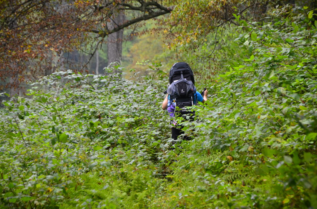
Parts of the trail are grown up with dense vegetation on both sides–such as blackberry patches.

Our little girl really enjoys riding in her backpack, and especially taking a nap in it. She spends about 5 hours in it by day’s end.

The HWA is entirely forested with a mix of deciduous hardwood trees and evergreen conifers. There is a dense forest canopy in most areas. The ground level is fairly open and vegetated with sparse woody shrubs, young trees, and an abundance of ferns. Wide open meadows hug both sides of the creek in the upper (northern) 2 miles of the trail. We believe the meadows represent the floodplain of the creek. Flash floods probably prohibit tree growth while promoting the establishment of grasses.
The trail runs along Hammersley Fork for the entire walk into the Remote Spot approach. Finding drinking water is not a problem. Just last week, we would have had to deal with a very flooded creek in the aftermath of intense heavy rains of Tropical Storm Lee. In fact, Lee was the reason we weren’t here a week ago.
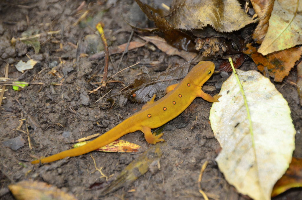
Ryan looks down for a brief instant. A magnificent red-spotted newt (Notophthalmus viridescens) ambles across the trail. This individual is called an eft. Newts are salamanders with multiple life history phases. The eft phase is dry-skinned and well-adapted to terrestrial life when not breeding. When it’s time to breed, efts enter water bodies and transform into the breeding adult phase, much different than the eft. The breeding adult sports a long, dorsoventrally tall tail fin. Its hind limbs become robust. The skin becomes slick and shiny. We would have to look in the creek to find one. They are enitrely aquatic. This particular species has an immense range all over the eastern U.S. and into southeastern Canada.

Newts just happen to be one of our career long biological research interests. Ryan and Rebecca currently run a 5-year research project in north Florida to bring another newt species back from the brink of extinction–the closely related and imperiled striped newt (Notophthalmus perstriatus). Click here to learn more about this conservation effort.
We make it to the point where we now must set out off-trail, up a very steep mountain side to reach the Remote Spot. Even though we only have to navigate off-trail for 0.1 miles, the steep elevation gain and rugged terrain make it strenuous. It feels more like a mile. Ryan carries Skyla, and we leave Ryan’s pack cached along the trail below.

Our handheld GPS beeps and notifies us that we have arrived at the exact coordinates of the Pennsylvania Remote Spot. It is a feeling of both satisfaction and anticlimax. After all, there is a hiking trail just a tenth of a mile below. But we remind ourselves that hiking trails are good and provide opportunities for people to experience nature on foot. Cars and roads are what we encourage people to reduce their usage of…not hiking trails!
The remotest location in the entire state of Pennsylvania is protected within the center of the Hammersley Wild Area, about 0.1 miles off the Hammersley Trail–up a very steep hillside.

At every Remote Spot we conduct our 15 minute Remote Spot Assessment (RSA). During this period, we record quantitative data on direct or indirect human presence/absence. We observe sights, sounds, and smells of anything of human origin, then we identify it, estimate distance, and record the compass bearing of the datum. This information helps us measure remoteness. Additional to the RSA, we also make ecological and wildlife observations. Last, and not least, we take high resolution, panoramic photo and video of the Remote Spot. Through Project Remote, we are measuring remoteness as it currently exists in the United States. This work provides a baseline of information on remoteness (i.e. roadlessness) that is useful to current and future roadless area conservation efforts.

Ryan gets some Daddy-daughter time at the end of our doccumentary work. We are amazed at how well Skyla has done all day and last night. The more exposure to the outdoors a child gets, the more comfortable in the outdoors a child becomes. Go figure.

After working and soaking up Pennsylvania remoteness, we decide that we can make it out of here tonight and position ourselves closer to our next Remote Spot adventure–West Virginia.
Project Remote Fundraiser: After reading this website, you might be surprised at just how hard it is to get away from a road or a town nowadays–and instantly understand that we must now as a nation speak out to protect remaining public roadless areas from further roads development. Project Remote is now over half-way done! Our goal is to raise enough funding simply to offset the cost of traveling frugally state by state, completing the documentary field work, and maintaining this website. This work depends on donations from people like you. If you like what we do, please make a donation to support Project Remote today. Thank you so very much for helping us to document and preserve Remote America…
–The Remote Spotters
